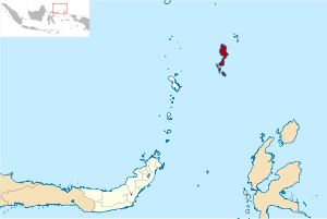
Totombatu Goa is a unique rock cave contains a collection of human skulls, located on the shoreline at the southern end of the village Tarohan, Karakelang Island, Talaud Islands. This cave is located on a small rock hill about 8 feet tall, which protrudes into the sea as far as fifty yards. It draws from this place is a stone structure that forms the cave is very diverse, consisting of rocks, limestone and older rocks are full of cracks.
Among the clusters that are indented notches formed caves, some of which form a large hole, so it can be passed by more than one human body. At the top of the rock structure covered with various trees and shrubs typical of coastal areas. On one set of lush shrubs on a hilltop stone cave that holds that there are 33 skulls and human bones. From this place we can see Salibabu island, Nusa islands in the harbor basin headland Lobo and Beo.
That said, according to locals speech, of yore, there is a plateau called Tarapahan, which means mountain of nine. On the mountain is believed by villagers Tarohan as ethnic origin Talaud. But there has been no definite story that tries to explain the existence of a collection of people in this Tarapahan plains. Some claimed that the collection of the society is a society of migrants from the island Mangindano, or the Philippines Mindanao.
 Taengetan added, the number of skulls and bones in the cave rock more than 100 pieces. This means there are 100 more ancestors who died and his head is taken to be put in a stone cave. One of the large number of skulls were nearly 50 cm in diameter are believed to belong Tatuhe. However, when visiting the cave Pontolondo only meet about 33 skulls were found alone and not the giant's skull as described Tatuhe locals. One thing to point out about the existence of a giant skull Tatuhe is the existence of segments of the human thigh bone and the calf which has a size of about 15 cm longer than the segment size of normal human bone Indonesia calf and thigh.
Told that the bones were missing from the cave because it is stolen, and the greatest place in the latter half of the 1960s when there was a group of people purporting to be from the Netherlands who then carry the number of objects including a large jar containing a giant skull. Urns and relics were later taken Taengetan according to the Netherlands and until now no more information that explains the existence of a number of the stolen objects.
Because of the narrowness of residential areas, the population Totombatu within the next 300 years since their arrival from the highlands Tarapahan then spread to the villages on the coast Karakelang. While most of which are still lagging behind and then moved to the north, precisely in the south end of the current Tarohan village, known as the literary language as Maninggungkota. In the mid-19th century, the population residing in Maninggungkota then moved again to a wider plains in the north up to now and in the village called Tarohan. Tarohan called because it is located between two rivers. But there are different versions about the name of the opening Tarohan Tarohan story of popular resistance to the Dutch. It is said that Tarohan derived from the Malay language "Bet". That village is at stake between Mangenti, king Tarohan with the Dutch colonial rulers who came from the direction Melonguanne and who intend to take over the village Tarohan. The bet was, if the king can not move people Mangenti of Maninggungkota within four months of the Tarohan will be taken by the Dutch. But the king with his people to build Tarohan Mangenti, both home and fortress that surrounds Tarohan in just 40 days and 40 nights.
Taengetan added, the number of skulls and bones in the cave rock more than 100 pieces. This means there are 100 more ancestors who died and his head is taken to be put in a stone cave. One of the large number of skulls were nearly 50 cm in diameter are believed to belong Tatuhe. However, when visiting the cave Pontolondo only meet about 33 skulls were found alone and not the giant's skull as described Tatuhe locals. One thing to point out about the existence of a giant skull Tatuhe is the existence of segments of the human thigh bone and the calf which has a size of about 15 cm longer than the segment size of normal human bone Indonesia calf and thigh.
Told that the bones were missing from the cave because it is stolen, and the greatest place in the latter half of the 1960s when there was a group of people purporting to be from the Netherlands who then carry the number of objects including a large jar containing a giant skull. Urns and relics were later taken Taengetan according to the Netherlands and until now no more information that explains the existence of a number of the stolen objects.
Because of the narrowness of residential areas, the population Totombatu within the next 300 years since their arrival from the highlands Tarapahan then spread to the villages on the coast Karakelang. While most of which are still lagging behind and then moved to the north, precisely in the south end of the current Tarohan village, known as the literary language as Maninggungkota. In the mid-19th century, the population residing in Maninggungkota then moved again to a wider plains in the north up to now and in the village called Tarohan. Tarohan called because it is located between two rivers. But there are different versions about the name of the opening Tarohan Tarohan story of popular resistance to the Dutch. It is said that Tarohan derived from the Malay language "Bet". That village is at stake between Mangenti, king Tarohan with the Dutch colonial rulers who came from the direction Melonguanne and who intend to take over the village Tarohan. The bet was, if the king can not move people Mangenti of Maninggungkota within four months of the Tarohan will be taken by the Dutch. But the king with his people to build Tarohan Mangenti, both home and fortress that surrounds Tarohan in just 40 days and 40 nights.
 Tarohan can be free for a while from the Dutch.
Successor to the king of kings Endang Mangenti Mentiri not follow in the footsteps of its predecessor to compromise with the Dutch. He did not want kerajaanya be part of the colonial Dutch. Thus the colonial government then took steps to bring some troops and soldiers to directly capture the king Endang. After a period of hiding from the Dutch, the king Endang then caught in the woods near the plains Tarapahan after the Netherlands-in-law persuaded the king Endang, the brother of the king's wife to show hiding Endang. Finally he was exiled to the island of Pigs, which is one of the islands adjacent to the island of Nusakambangan.
In a way that is not in the know by the people, the king Endang can finally escape the island and return to Tarohan Pigs. Arriving at Tarohan he then promptly handed the reins of power into the hands of the king Aaron Sarendeng and he later changed his name to Mangule. This event coincided with the attack on the Dutch-led Tukunan Arangka'a Larenggam led by the king in 1893.
With the passing of time, too Tarohan changed, the fortress that surrounds the village which was once the royal city and then collapsed by an earthquake in 1936 and was followed in 1971. While some relics of the ancient weapons of the Dutch are now beginning to be damaged by rust, and stored at home local residents. In the end Tarohan history, stories and Totombatu Tarapahan stored only in the minds of traditional elders and was almost lost in the absence of documentation and care of the younger generation Tarohan, Talaud government and society in Talaud culture lovers. Hopefully, this worry is not the case, and the story of Tarapahan, Tarohan history and existence of a unique Totombatu can be maintained from generation to generation.
Tarohan can be free for a while from the Dutch.
Successor to the king of kings Endang Mangenti Mentiri not follow in the footsteps of its predecessor to compromise with the Dutch. He did not want kerajaanya be part of the colonial Dutch. Thus the colonial government then took steps to bring some troops and soldiers to directly capture the king Endang. After a period of hiding from the Dutch, the king Endang then caught in the woods near the plains Tarapahan after the Netherlands-in-law persuaded the king Endang, the brother of the king's wife to show hiding Endang. Finally he was exiled to the island of Pigs, which is one of the islands adjacent to the island of Nusakambangan.
In a way that is not in the know by the people, the king Endang can finally escape the island and return to Tarohan Pigs. Arriving at Tarohan he then promptly handed the reins of power into the hands of the king Aaron Sarendeng and he later changed his name to Mangule. This event coincided with the attack on the Dutch-led Tukunan Arangka'a Larenggam led by the king in 1893.
With the passing of time, too Tarohan changed, the fortress that surrounds the village which was once the royal city and then collapsed by an earthquake in 1936 and was followed in 1971. While some relics of the ancient weapons of the Dutch are now beginning to be damaged by rust, and stored at home local residents. In the end Tarohan history, stories and Totombatu Tarapahan stored only in the minds of traditional elders and was almost lost in the absence of documentation and care of the younger generation Tarohan, Talaud government and society in Talaud culture lovers. Hopefully, this worry is not the case, and the story of Tarapahan, Tarohan history and existence of a unique Totombatu can be maintained from generation to generation.